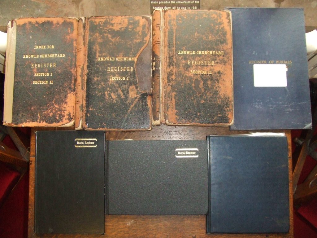
This website holds an online copy of the Knowle Parish Church Burial Register, a collection of several large volumes dating prior to 1900, and, over a century later, still being updated with new interments. These tomes variously list interments by Date, by Surname and by Plot Number; this duplication is an inherent source of human error. Any errors that have been found have been annotated in the Notes field of the Data Table.
This website comprises this help page and the Data Table page that contains the records from the Register. That page also provides links to plans of the churchyard to enable plot location on the ground.
Limitations of this website
All of the records are included in this online demonstration, but because of space limitation not all fields in those records are included in full (see below). A full record of any particular interment that interests you can be obtained from the Parish Office. It is recommended that this page is not viewed in portrait mode on a smartphone as this may limit the number of fields visible. Viewing the page in landscape mode or either on a tablet or laptop/desktop will generally provide a view of all seven fields available namely: Name, Plot, Address, Age, Date, Minister & Notes.
The date shown is a composite field (not suited for sorting by date). The underlying records include three possible dates, Death, Burial or Interment of Cremated Remains (so called ‘Ashes’). The type of date is shown as either B or C depending on whether there has been a burial or cremation. Where a date is available but this date is not defined, it could be any one of the three options and is shown as ? followed by as much of that date as is available (sometimes only the year). These unknown dates may be assumed to be burial dates for most interments in the 19th and 20th Centuries. Post-Millennium interment records also include the date of death but that additional date is not included in this online website, except where it is the only date available and it will again be shown as ?; contact the Parish Office for a full record if required.
Fields from the source database held by the church that have either been reduced in content or omitted altogether are:
- The last known Address of the deceased which is shown only by the first two lines of that address.
- Interment Order within a plot – i.e. who was buried first or second, etc. though this can often be inferred by date.
- The name of the Officiating Minister (where known) is limited to the surname only and does not include initials, title, function or home church [Note that quite often an Interment of Cremated Remains, which usually takes place some weeks after a funeral service, may be officiated by someone other than the ordained clergy, such as a Lay Reader or a Verger. Note also that interment sometimes takes place anything up to several decades after death].
- The very oldest graves (mostly prior to 1900 but a few in the following decade) are in sections 4 to 11 and cannot be located precisely on the churchyard plans, however the details of Row and Plot for Sections 4 and 5 are included in the Notes column and help more precise location of plots in these Sections.
- Reference numbers from the more recent date-order burial registers and the unique record numbers created by the underlying database have not been shown, as the search capabilities of the website here obviate the need for such references.
Section and Plot numbers
The location of an interment plot is shown as a reference in the form ss/pppp where ss is one of thirteen sections of the churchyard (see below) and pppp is the plot or grave number in that section, sometimes with an A or B suffix.
| 0 – Ashes scattered (Not allowed without a Faculty) |
| 1 – Section I (New Area – closest to church) |
| 2 – Section II (New Area – farthest from church) |
| 3 – Section III (Garden of Remembrance) |
| 4 – Pre-1945 north of church – left/west of north-south path |
| 5 – Pre-1945 north of church – right/east of north-south path |
| 6 – Pre-1945 east of church |
| 7 – Pre-1945 south of church |
| 8 – Pre-1945 west of church |
| 9 – Repositioned gravestones along the Kenilworth Road wall (starting at the north end) |
| 10 – Repositioned gravestones along the Paterson Court wall (starting at the east end) |
| 11 – Outside Soldiers’ Chapel window |
| 99 – Unassigned interment plot |
Using the Data Table
You may expand the table by selecting how many entries (10, 25, 50 or 100) are to be shown on the screen – failure to select a large enough number may inadvertently hide some of your search results. To find a name, a plot or any other data, use the search box just above the data table. Enter the whole, or whatever part, of a text or numeric string you wish; for example to find Smythe-Jones (not a real record) in 15/123B you could get straight there just by typing either he-j or 123b, either of which would probably be unique search criteria. If you enter just a surname or a plot number you will see all the people of that name or all the interments in that specific plot. Searches are not case dependent.
Using the plans to find a grave
On the Plans page there is an overall diagram (reference: MAP) of the churchyard showing the notional location of the different Register Sections and the numbering scheme of the burial area.
Two other links provided on the Plans page will take you to:
a) a six page PDF file of the grave plots in the churchyard (Reference CY) . Note that all six pages of this PDF run from left to right, Page 1 on the far left (South) and Page 6 on the far right (North). The top of the plans face St John’s Hall and the car park, the bottom face the National Trust Children’s Field and Paterson Court.
b) a three page PDF file of the interment plots in the Garden of Remembrance (Reference GR); this is best viewed at a zoom level of at least 150%. The top of this plan faces East (towards the National Trust Children’s Field and Paterson Court). The bottom of the plan faces the East window of the church. The right of the plan faces the Kenilworth Road.
Using the name of the deceased person and the cell reference found in the Data Table you can search for the location of the required plot within the Knowle Parish Church churchyard. Cell references work in the same way that spreadsheets do, with letters alphabetically and horizontally left to right across the top and numbers vertically from top to bottom down the left.